
The Mangystau region, also called Mangistau, is located in south-western Kazakhstan, east of the Caspian Sea. Its capital is Aktau, formerly known as Shevchenko, and is often referred to as the Sea Gates of Kazakhstan. The area is home to approximately 814,000 residents and covers 165,600 square kilometres, about twice the size of Austria. Mangystau is a vital industrial centre, producing around a quarter of Kazakhstan's oil, making it one of the country's wealthiest regions. Despite this, the region's breathtaking natural beauty, including remarkable canyons, cliffs, and mountains, is often overlooked. Mangystau's landscape feels like stepping back in time, with wild horses and camels roaming freely across vast, dry steppes that meet rugged mountains beneath endless skies. Human presence is sparse, allowing nature to dominate. I personally find this region to be one of the most captivating places in the world, offering a sense of isolation that seems like entering another realm. If you're after a unique and extraordinary experience, Mangystau is definitely worth visiting.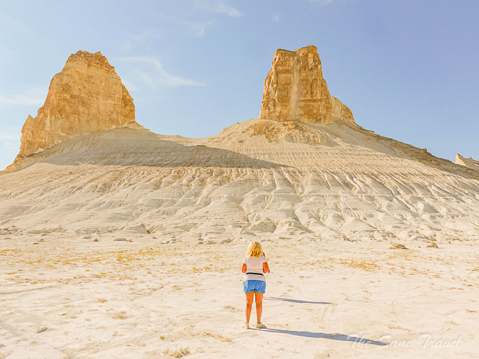
How to visit Mangystau
The natural wonders of Mangystau lack proper infrastructure and are mainly accessible via dirt roads. Many areas lack access to water resources, and staying in a tent for lodging is often necessary. Google Maps provides limited information about the region, making it challenging to visit independently. I recommend hiring a local guide who is familiar with the area, owns an SUV, is a skilled driver and chef, and is hospitable. I personally chose Ruslan Churov from Mangystau Explorer, as recommended by other travellers. He offers tours in both Russian and English and limits the number of travellers to three in his off-road SUV. I travelled with two companions, but larger groups can be accommodated by coordinating with other trustworthy drivers. This review is based on my experience during a five-day tour of Mangystau, where I spent one night in a yurt instead of camping in tents for all four nights, as stated in the regular tour offer.
Ustyurt Plateau
The Ustyurt Plateau, a vast landform spanning three countries, is home to many natural marvels in Mangystau. The plateau features 100-metre cliffs with distinct layered structures and shapes, formed over millions of years by the action of water and wind. It emerged between 20 and 60 million years ago, once part of the ancient Tethys Ocean. Fossilised remains of prehistoric marine life can be found in the lower and middle rock layers of the cliffs. Various scenic locations in Mangystau offer opportunities to explore the Ustyurt Plateau, each with its own distinctive landscape of long, high cliffs. Popular scenic sites include the Tuzbair salt flat, Bozzhyra valley, and Karynzharyk depression, each presenting its own unique landscape with tall cliffs.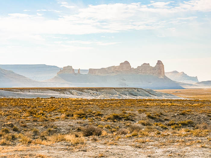
Day 1
Karynzharyk Depression
Driving to Zhanaozen city for 1.5 hours on a paved road. Driving to Karynzharyk for 4 hours on a dirt road. Total distance covered: 300 kilometres.
After meeting our driver-guide and getting into a 4-wheel drive SUV in Aktau, we set out on our adventure.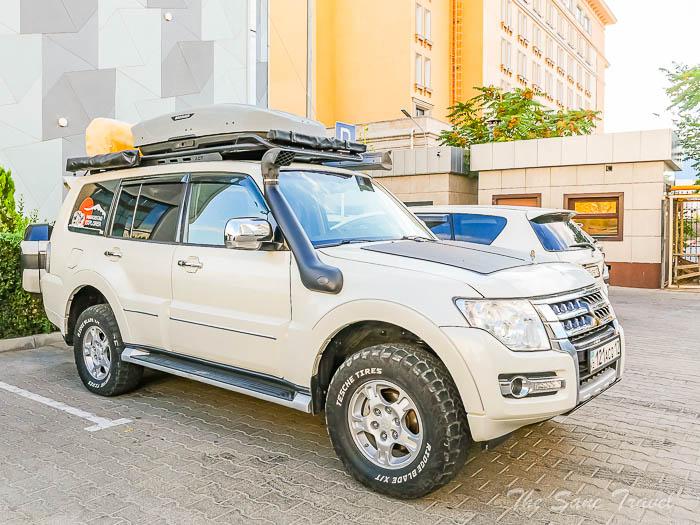
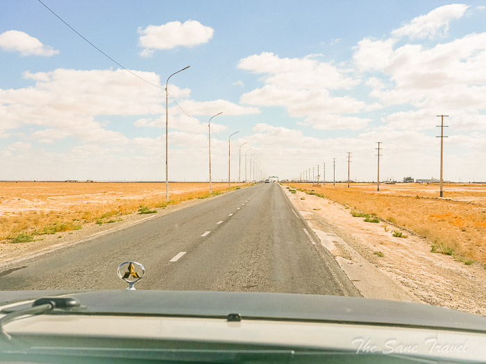 Our first destination was Zhanaozen town, which translates to "new river" in Kazakh and was established in 1964 following the discovery of an oil field in Uzen. We refuelled the car with gas, a common fuel in the area due to its availability, as it was the last place to find shops before three days of travel through sparsely populated steppe.
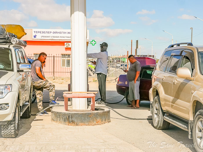
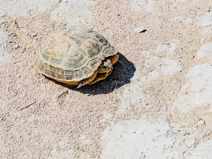
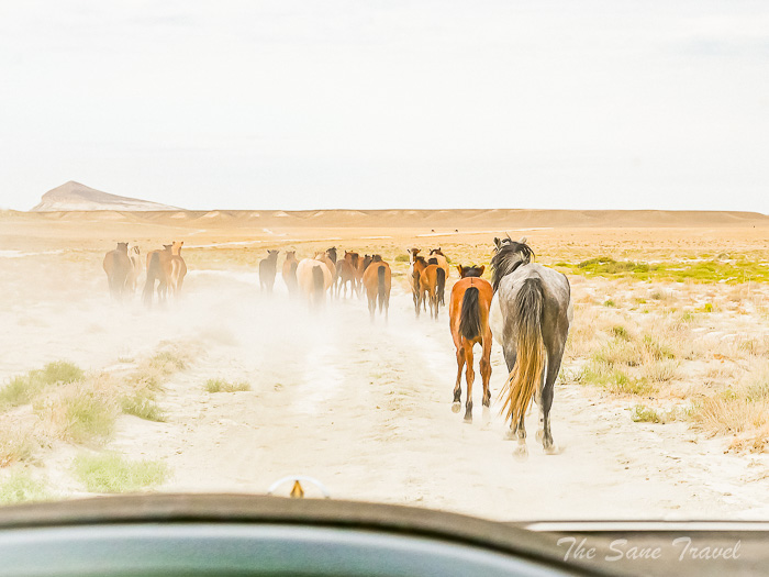
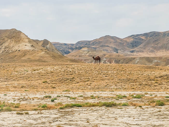
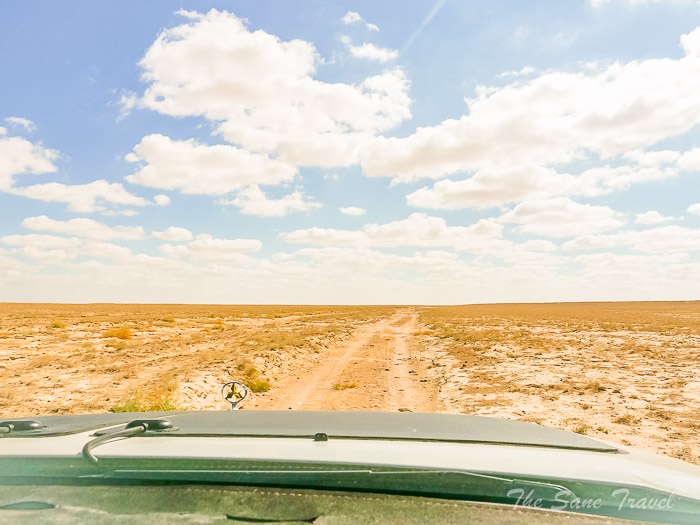 As we left the city and entered the dirt steppe road, we encountered sheep, camels, horses, and even a small turtle along the way.
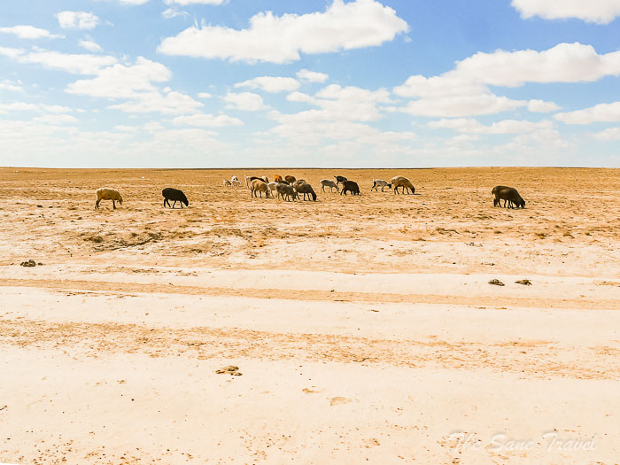
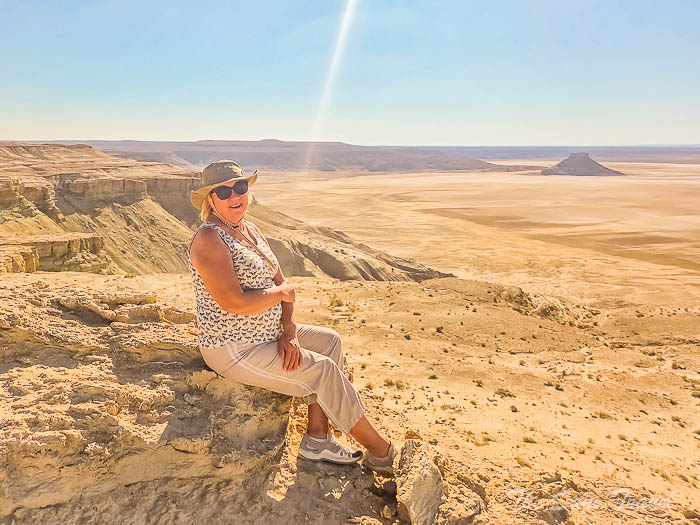
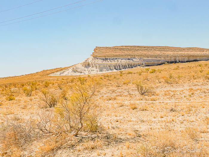
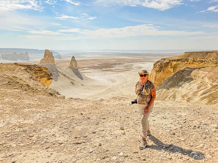
 Our next stop was at one side of the Karynzharyk Depression, where we took a brief break to explore and capture some photos.
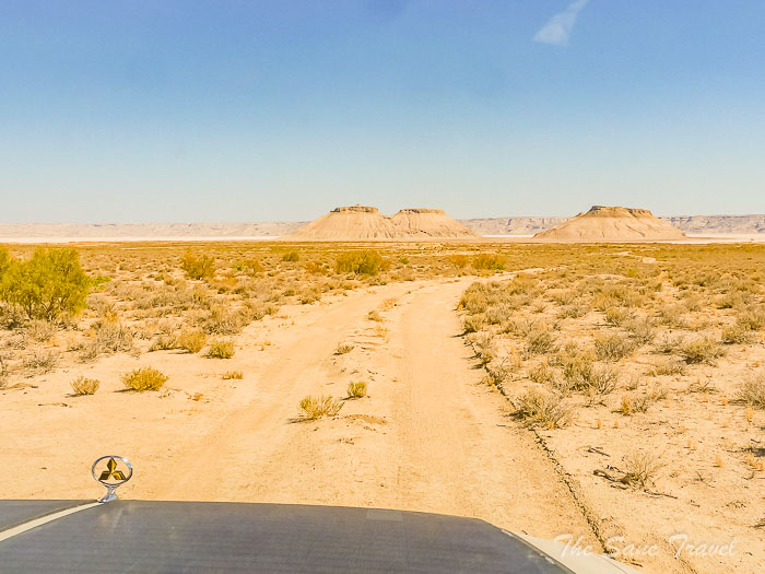
 We then moved on to the other side of the depression for an overnight stay.
Karynzharyk Depression
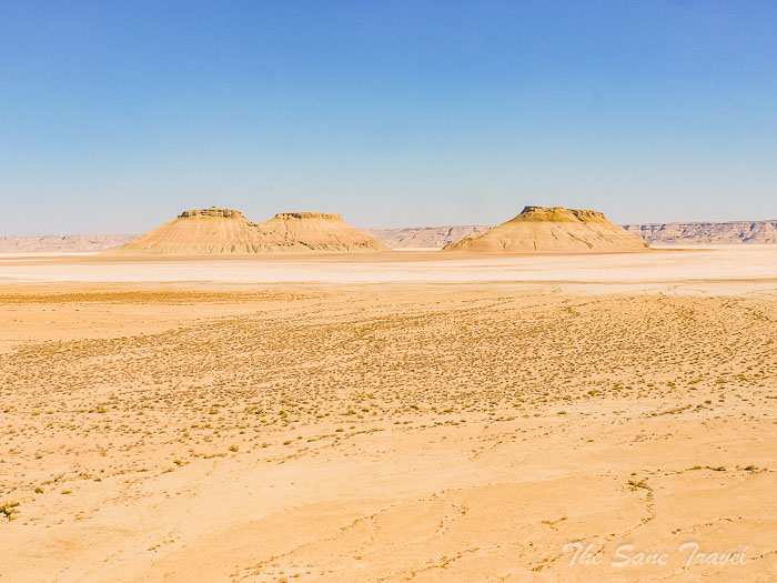
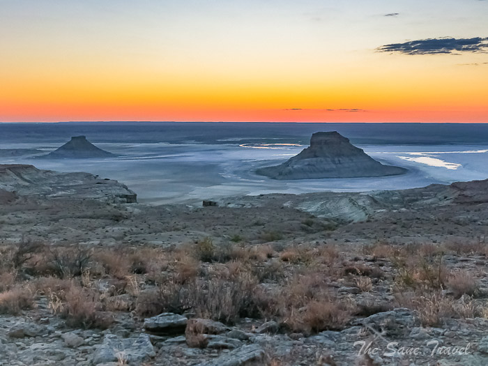
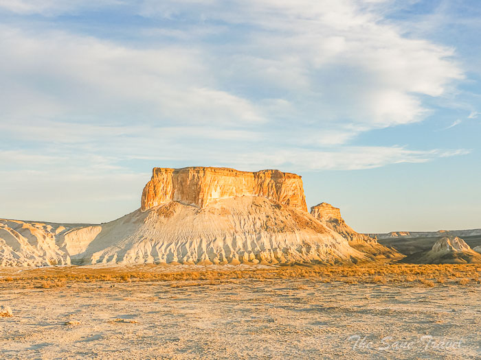
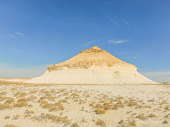
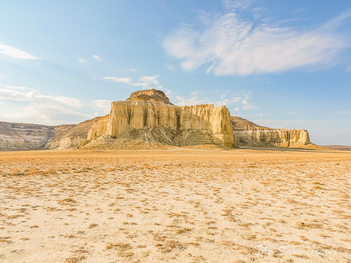
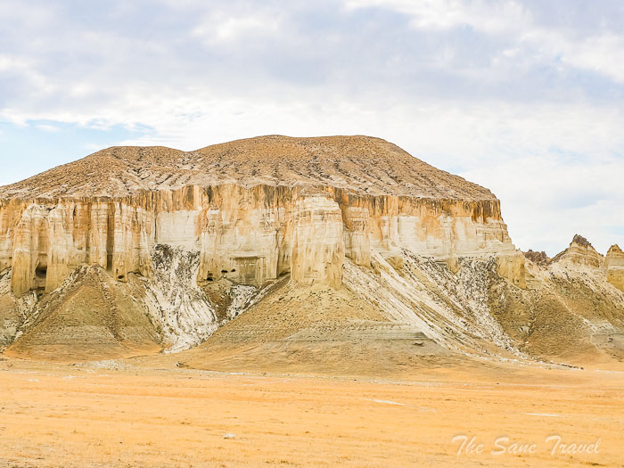
The Karynzharyk Depression is a stunning location with unique landscapes that may remind visitors of another world. It is situated in the southern part of Mangystau, near the border with Turkmenistan, covering an area of 2,000 square kilometres and reaching a depth of 75 meters below sea level. The region includes the Kenderli Salt Flat, the Karynzharyk Desert with sandy hills, and five remnant mountains. The mountains, particularly the "Three Brothers," rise above the salt flat, creating a picturesque sight that changes with the weather and time of day.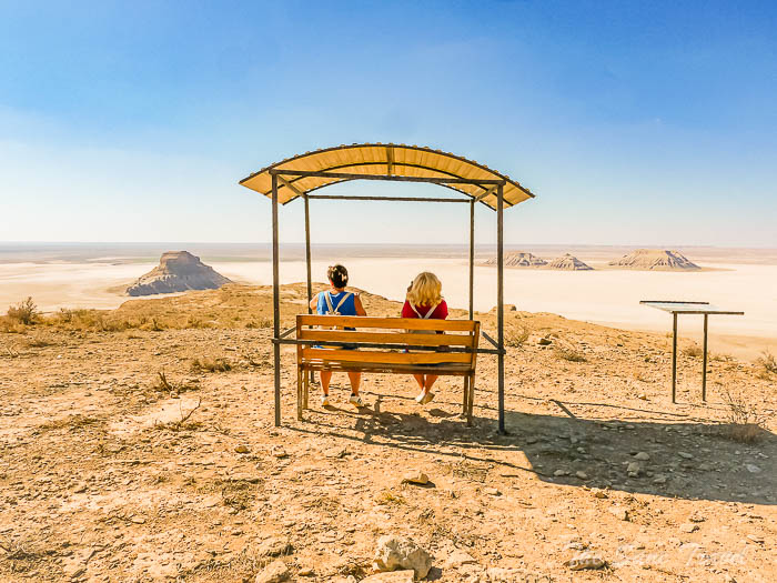
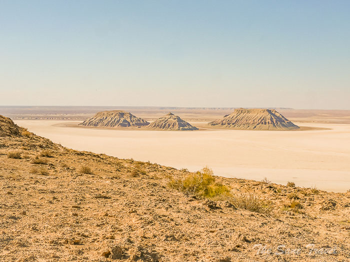
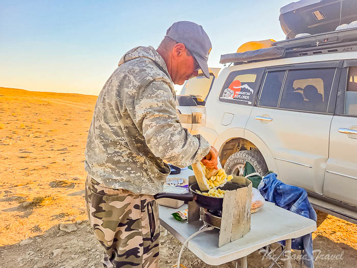
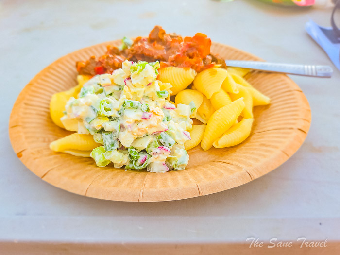
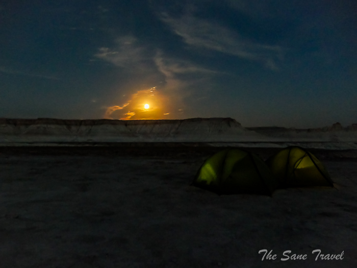
 After rainfall, the salt flat becomes a reflective surface, enhancing the beauty of the landscape. Due to its remote location and day-long journey to reach it, Karynzharyk is less visited by tourists compared to the popular Bozzhyra. We were the only visitors there. The guide set up individual tents for each of us and prepared a delicious dinner.
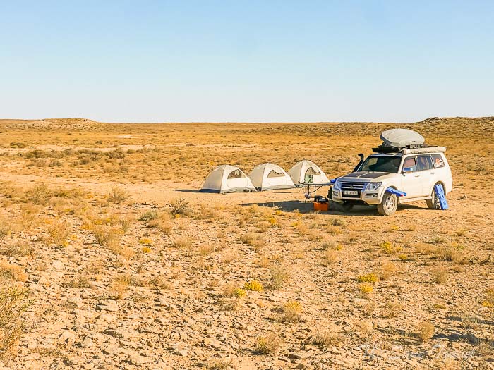
 We enjoyed watching a beautiful sunset and the full moon at night.
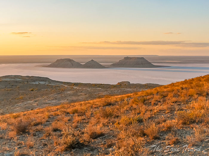
Day 2
Onere Spring, and the Bozzhyra tract. 180 kilometres on dirt roads.
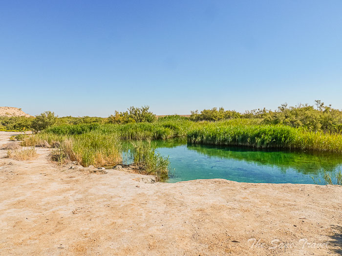
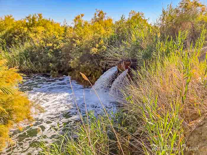
After eating breakfast and packing up our campsite, we travelled to the Onere Spring, where we found a small pond with clear blue water. Despite the cold temperature, we enjoyed a quick swim before continuing to Bozzhyra.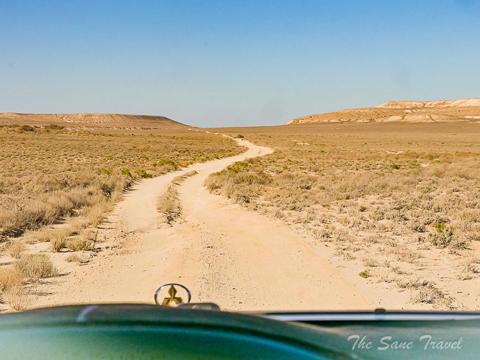
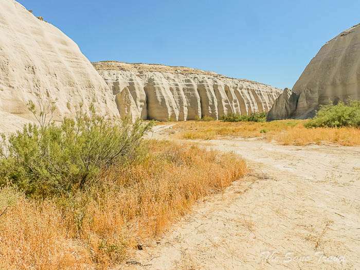
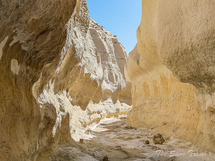
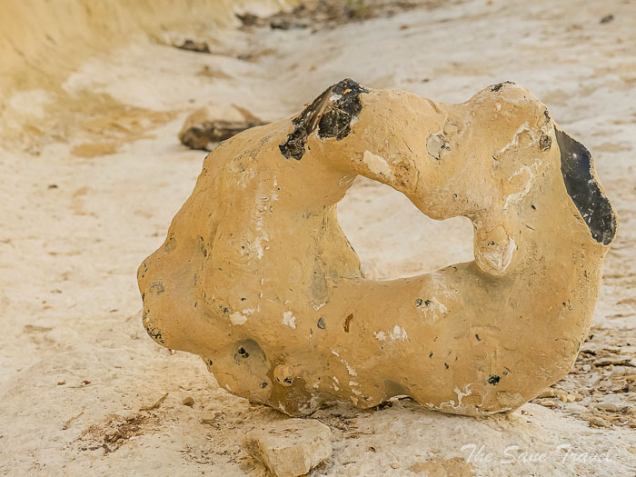
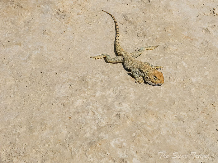
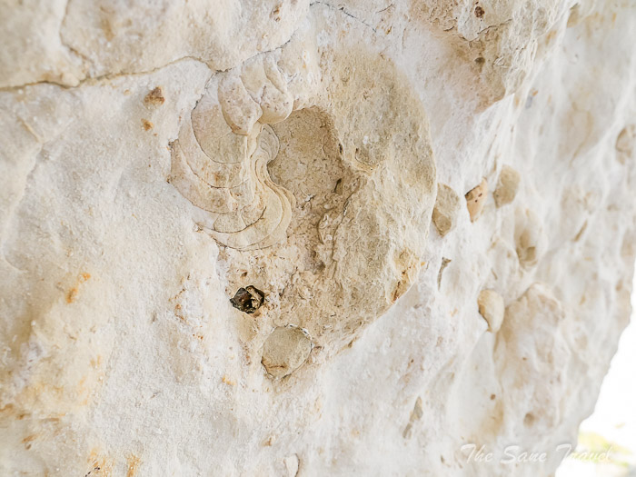
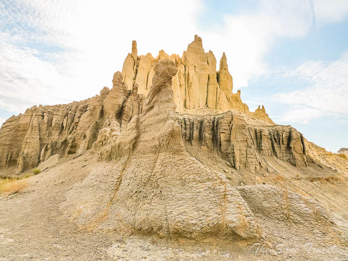
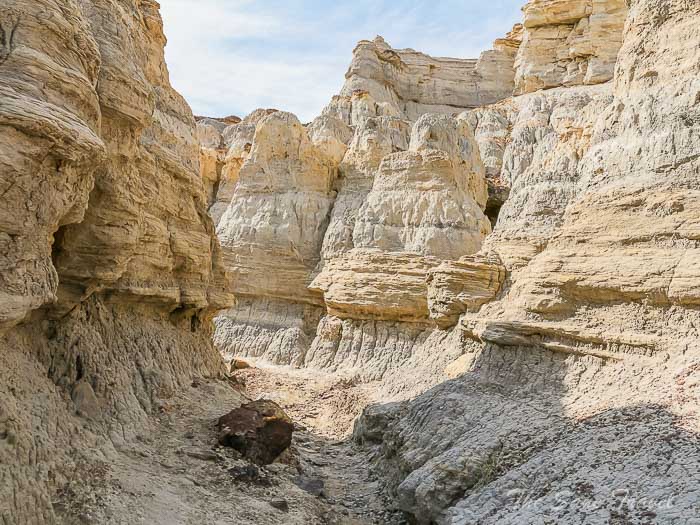
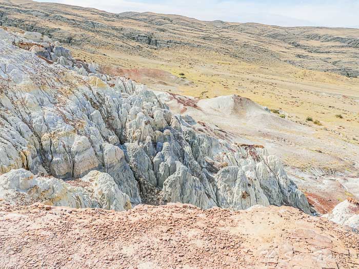
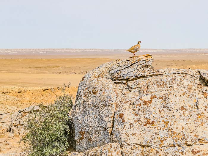
 Along the way, we stopped at a white canyon with unique rock formations and encountered a curious animal there.
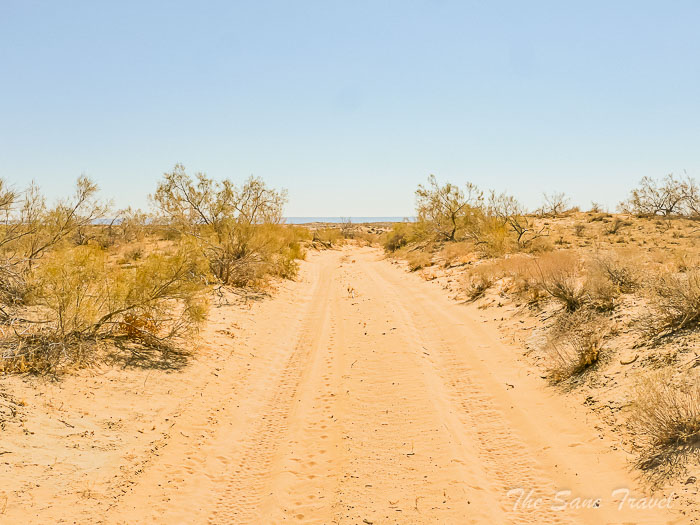
 We then continued our journey to explore the Bozzhyra tract.
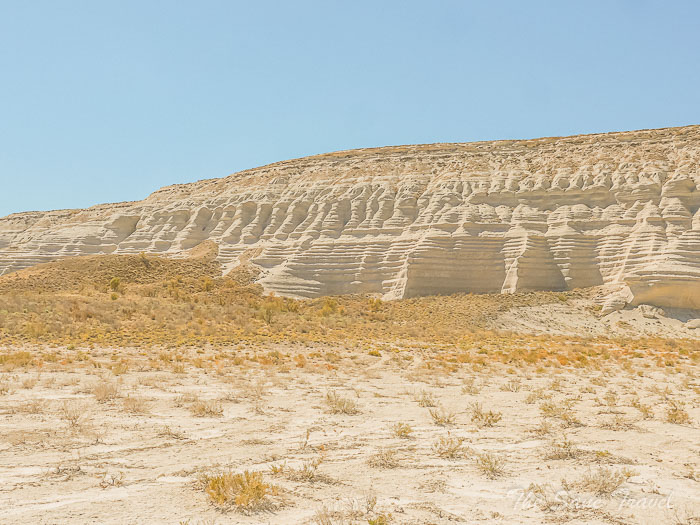
The Bozzhyra tract
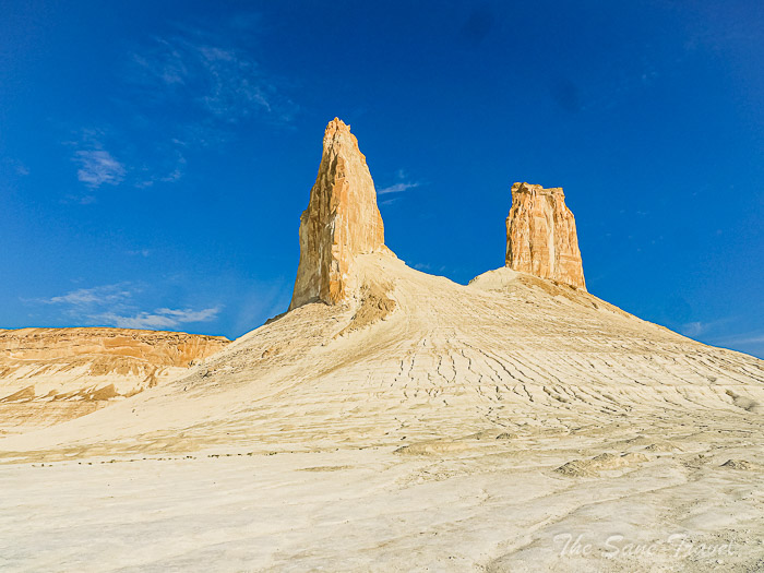
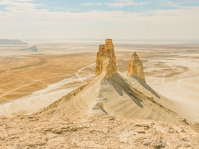
The Bozzhyra tract in Mangistau is renowned for its stunning and otherworldly landscape, with residual mountains reaching heights of over 250 meters. The park's vast size offers multiple viewpoints to admire its grandeur, as it is part of the Ustyurt Plateau. Tourists are drawn to the area's dazzling white chalk cliffs and unique rock formations, such as the iconic "Bozzhyra Fangs." The region's geological features include deep canyons, panoramic plateaus, and fossilised remains of ancient marine life.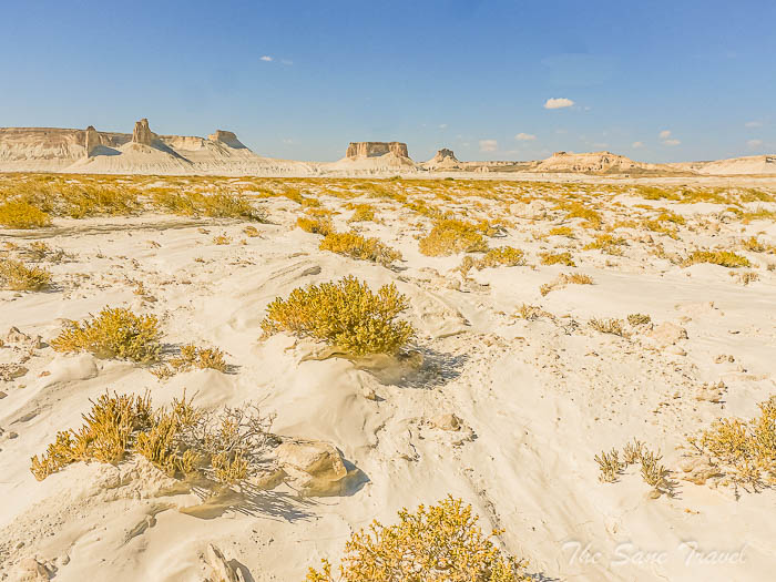
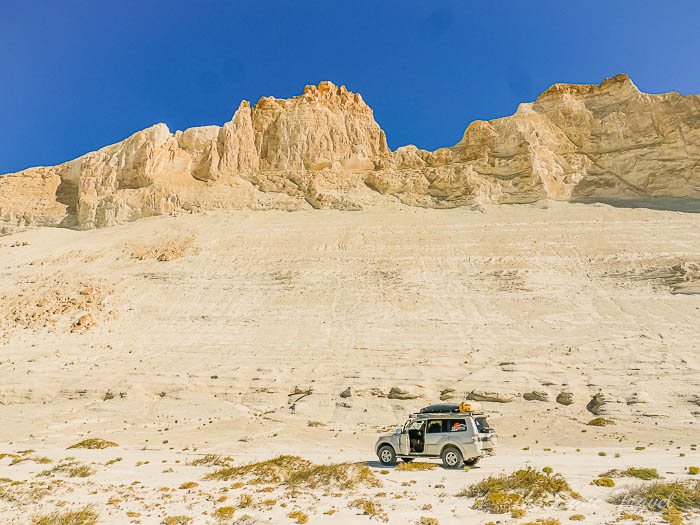
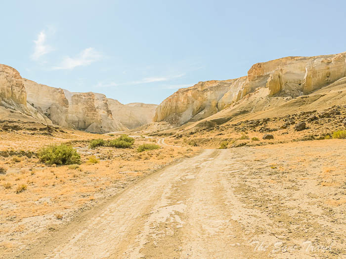
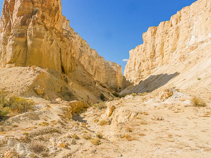
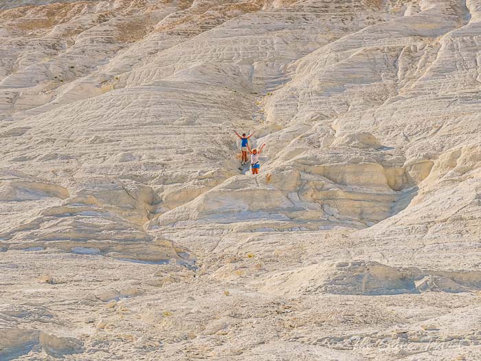
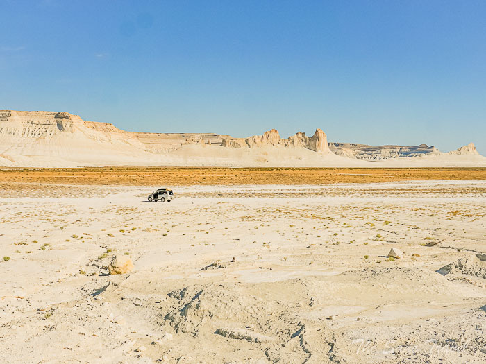 Photo tours are popular for capturing the interplay of light and shadow, with the landscape showcasing various colours throughout the day. The area is also ideal for astrophotography at night due to minimal light pollution. Our campsite, situated beneath the Bozzhyra Fangs, provided opportunities to admire the landscape's beauty at various times of the day.
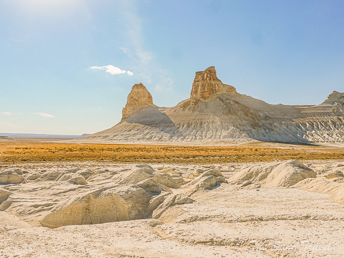
Day 3
Exploring the Bozzhyra tract, Kyzylkup tract, and Tuzbair Salt Flat. Distance covered 170 kilometres, mostly on dirt roads.
Exploring Bozzhyra tract
After eating breakfast, we drove to the first scenic overlook located 270 meters above sea level, providing views of the Ustyurt Plateau.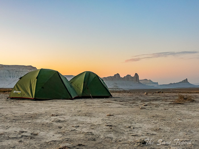
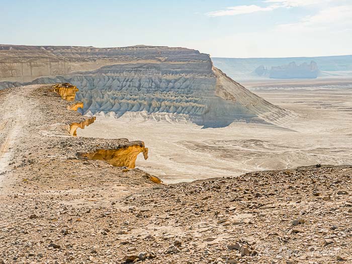 From this spot, we could see Shoky-Tau Mountain at 266 meters above sea level, as well as Yurta Mountain.
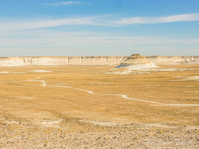
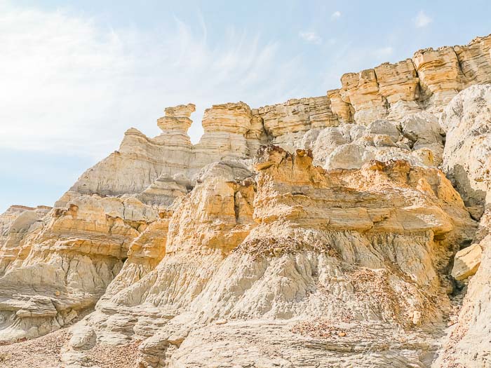
 The snow-white chalk cliffs resembling a fantastic mountain range were also visible from this vantage point.
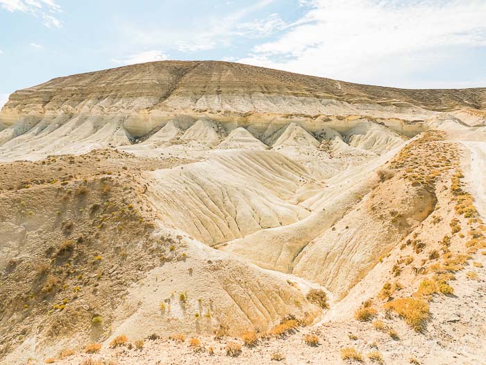
 We then visited the higher observation decks to appreciate the panoramic views of Bozzhyra and took stunning photographs.
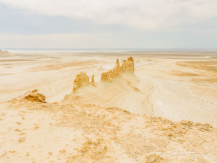
Our next stop was the Kyzylkup tract.
Kyzylkup tract
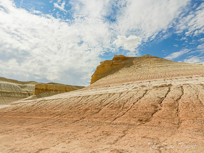
The Kyzylkup tract, also known as "Tiramisu," is a collection of brightly coloured hills consisting of red and white layers of ancient chalk rock, spread out over several kilometres in the Kazakh steppe. The nickname "Tiramisu" was given by local guides as a marketing strategy, as the hills and cliffs resemble the famous Italian dessert. The original name, Kyzylkup, comes from a dried-up reservoir in the area, translating to "a lot of red" in Kazakh. The formation of the Kyzylkup tract, like many attractions in Mangystau, can be traced back to the ancient Tethys Ocean. The unique red colour of the rock layers is due to periodic enrichment with iron impurities, while shades of yellow and brown come from a mix of minerals. Visitors mainly come to see a cluster of hills with a picturesque gorge, where the red layers form long curves. There are chances to hike through the gorge or climb to the summit, which provide breathtaking views of the landscape that resembles Mars.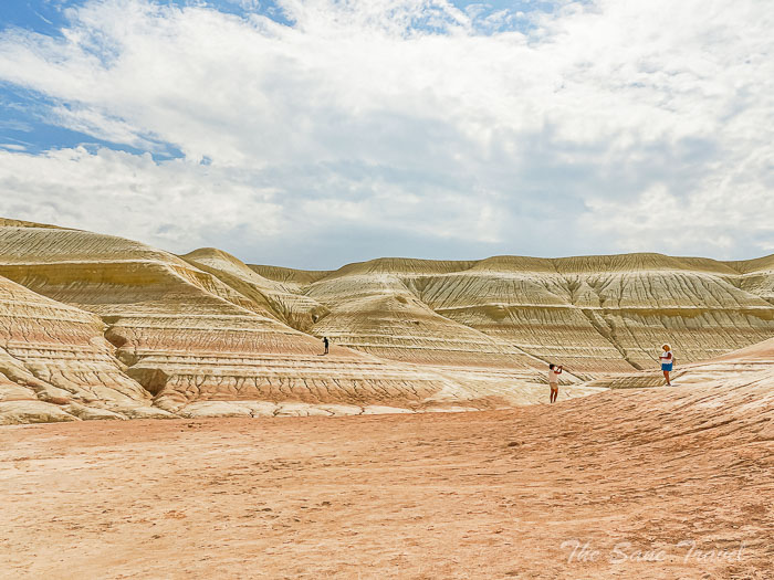
Tuzbair Salt Flat
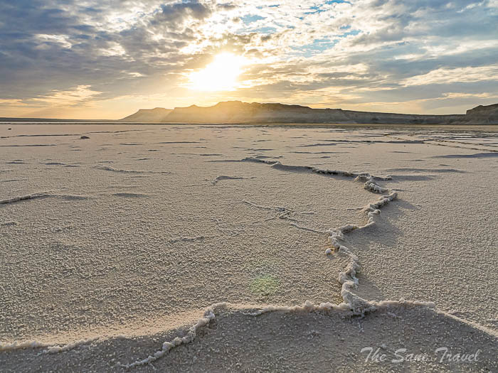
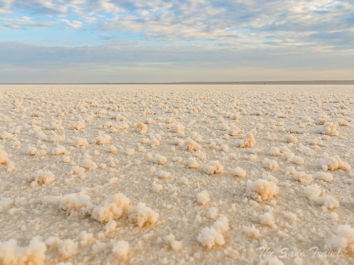
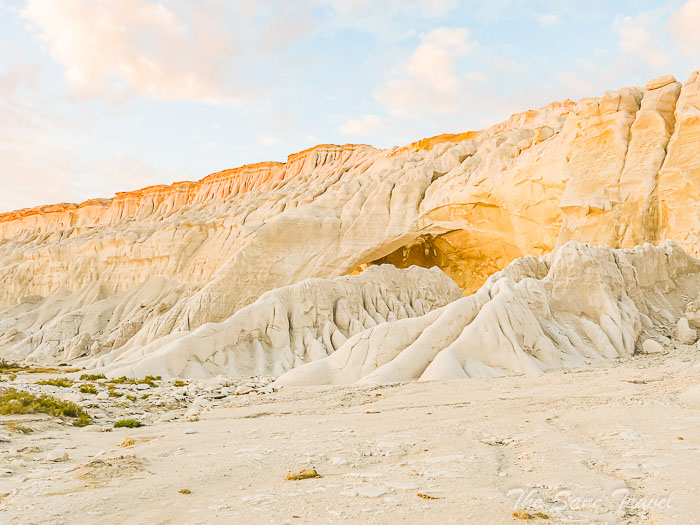
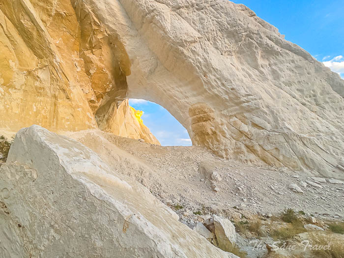
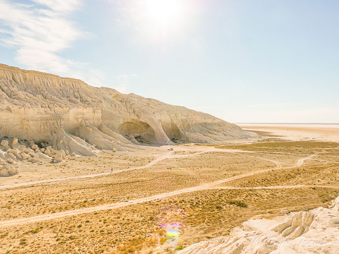
Tuzbair Salt Flat, also known as Sor Tuzbair, is a distinctive salt marsh located near the steep sides of the western Ustyurt Plateau. Known locally as "sor Tuzbair," this salt pan is characterised by its shallow, non-draining salt marsh. During the spring, rainfall fills the salt pan, transforming it into a shallow lake that reflects the sky and the surrounding buttes, offering a stunning view. In the summer, the water evaporates, leaving behind a thick crust of salt that visitors can walk on. The Plateau's steep cliffs, made up of sedimentary rocks, showcase remarkable shapes that captivate observers. Stretching for over 8 kilometres, the snow-white salt marsh provides a diverse and picturesque landscape. The weathered rocks of Tuzbair exhibit unique formations, such as a chalk arch that is a favourite spot for photographers. We spent a night at Sor Tuzbair, allowing us to see breathtaking views of the area during sunset and sunrise, when the surroundings take on a magical hue.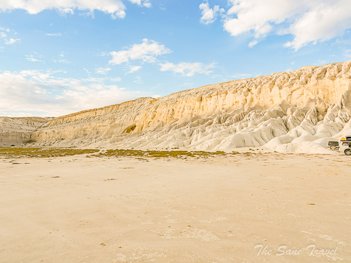
Day 4
Karaman Ata, Ybykty Sai, Ethno village Kogez. Distance covered 170 kilometres, mostly on dirt roads.
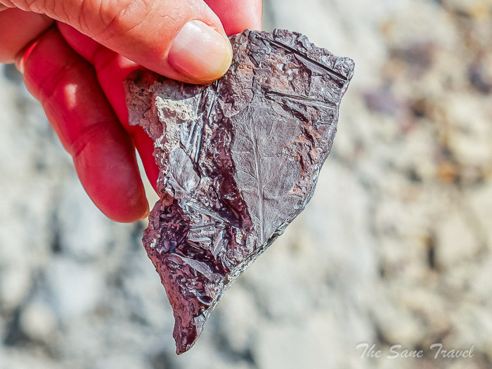
After eating breakfast and preparing our belongings, we dedicated some time to hiking up to the summit of the beautiful butte in Tuzbair and later searching for areas containing fossilised prehistoric shells.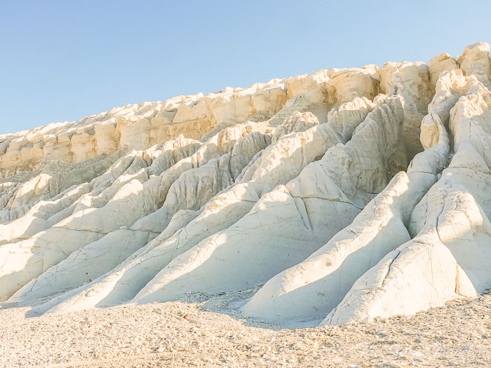

 Following this, we travelled to Zharmish town for lunch. Our subsequent destination was the Necropolis and the underground mosque of Karaman Ata.
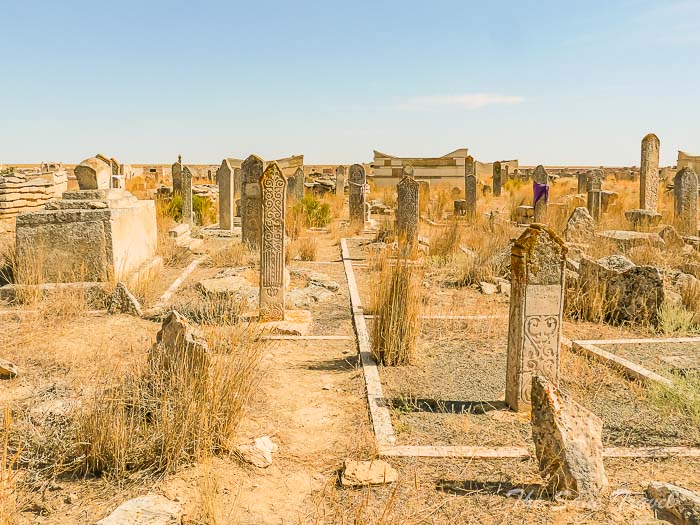
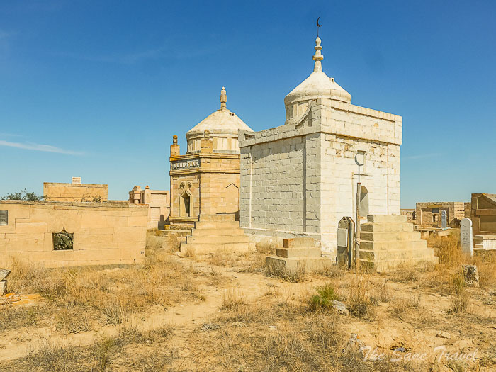
Necropolis and underground mosque of Karaman Ata
In 1951-1952, an expedition led by M. Mendikulov first explored the monument, attributing the construction of the Karaman Ata mosque to the 12th century. The Karaman ata necropolis in Mangystau is considered one of the oldest and largest necropolises in the region, consisting of Turkmen steles from the Middle Ages, stone tombstones, saganatams, and mausoleums built by the Adal family. 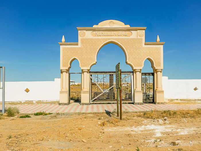
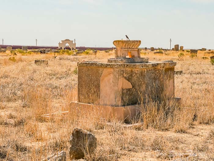
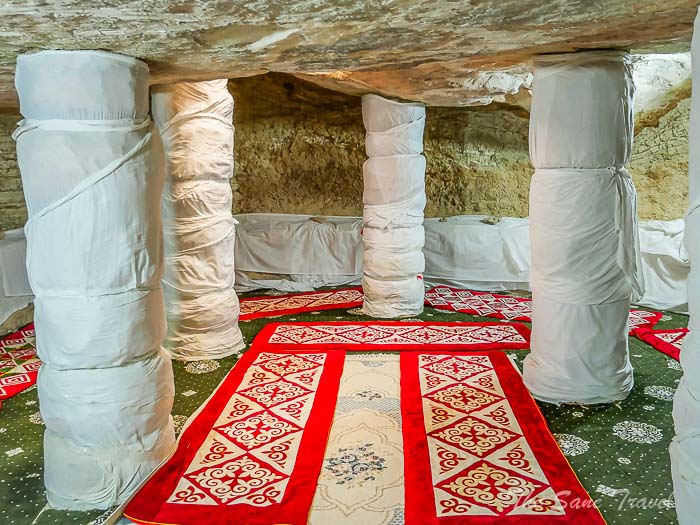
 The Karaman Ata underground mosque, located to the west of the necropolis, was carved into a marri rock and consists of three main rooms: a corridor, a prayer hall, and a round room where the Kararnan Ata crypt is said to be located. The entrance room leads to the main gallery, where religious rituals and prayers are held. The monument has a low ceiling due to its shallow foundation.
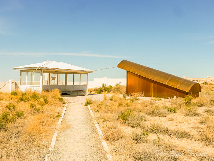
 The next destination for the expedition was Ybykty Sai.
FYI
Saganatam is a type of rectangular stone fence made from processed stone, typically featuring a raised western wall with a window opening. It is a common form of gravestone structure in the region, often referred to as sarcophagi or mausoleum.
Ybykty Sai, a hidden treasure of Mangystau
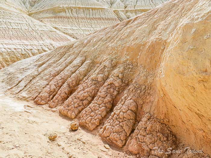
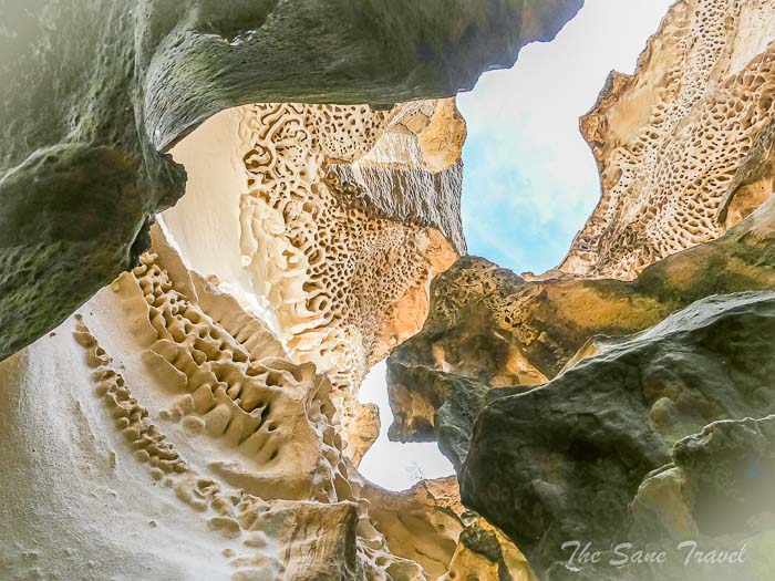
Ybykty Sai is recognised as one of the oldest natural landmarks, with the canyon forming around 66-41 million years ago in Kazakhstan's deepest depression, the Karagiye Basin, 132 meters below sea level. Local tradition suggests that mountain goats once roamed the canyon, which may explain its name, meaning "mountain goat ravine" in Kazakh. The limestone cliffs of Ybykty Sai showcase unique and intricate shapes, ranging in height from 3 to 6 meters, with visitors likening the patterns to aerated chocolate, sea corals, delicate lace, and honeycomb. The canyon, though relatively short in length, captivates all who visit, as its appearance changes throughout the day with the shifting light filtering through a narrow crevice from above. 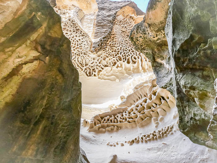
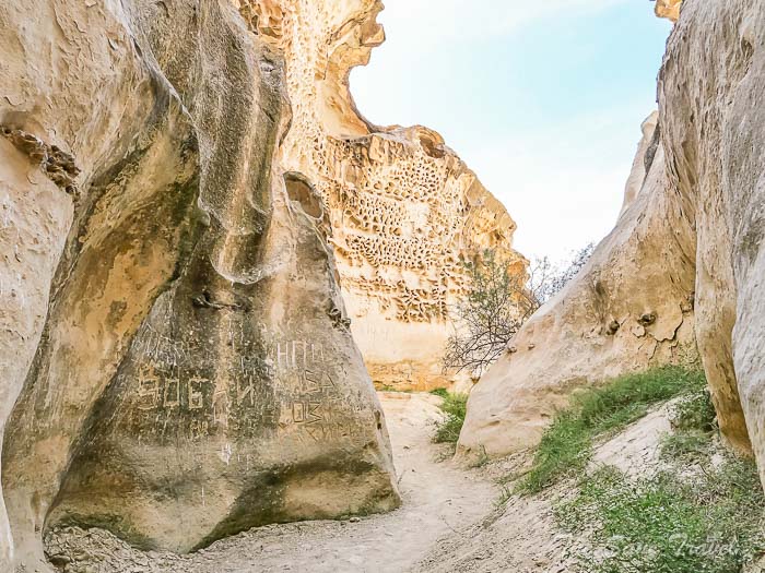 Despite its recent rise in popularity, Ybykty Sai remains relatively unknown even to locals, but its reputation as a remarkable natural wonder is steadily growing, attracting more tourists eager to experience its beauty. Next, we made a stop at a place with an unknown name.
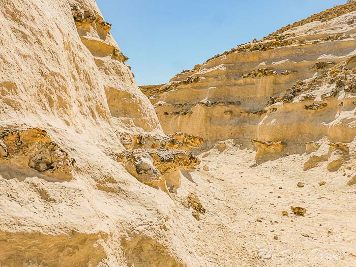
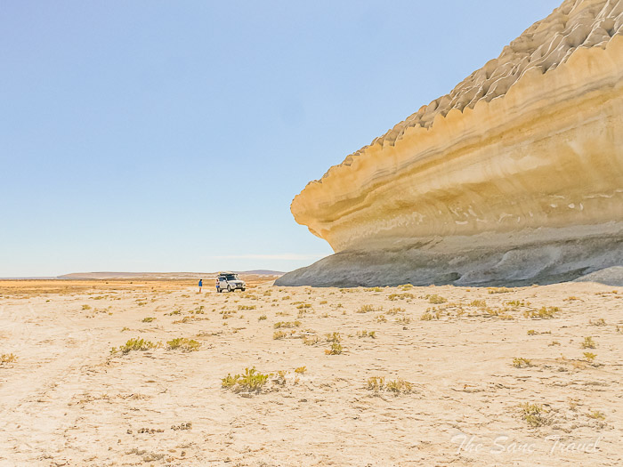
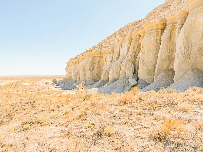
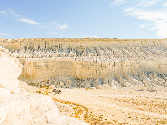
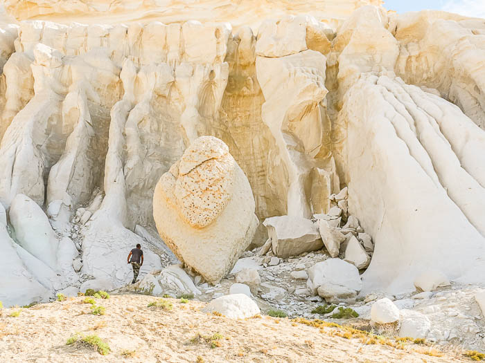
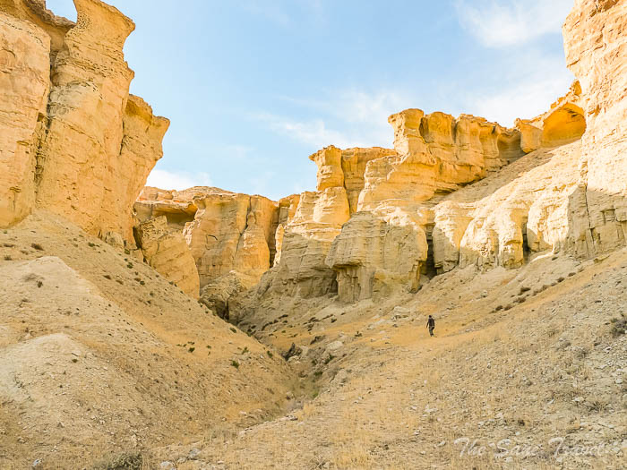
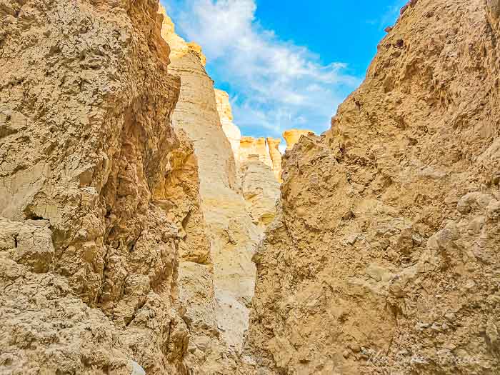
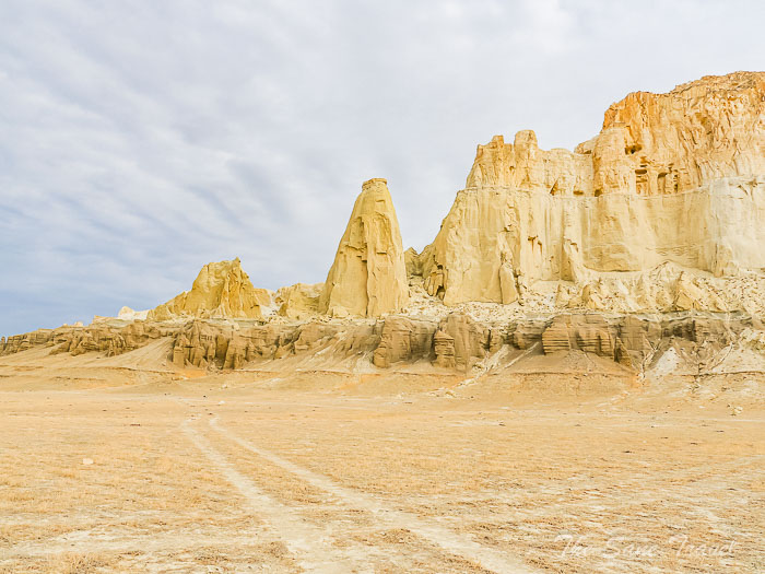
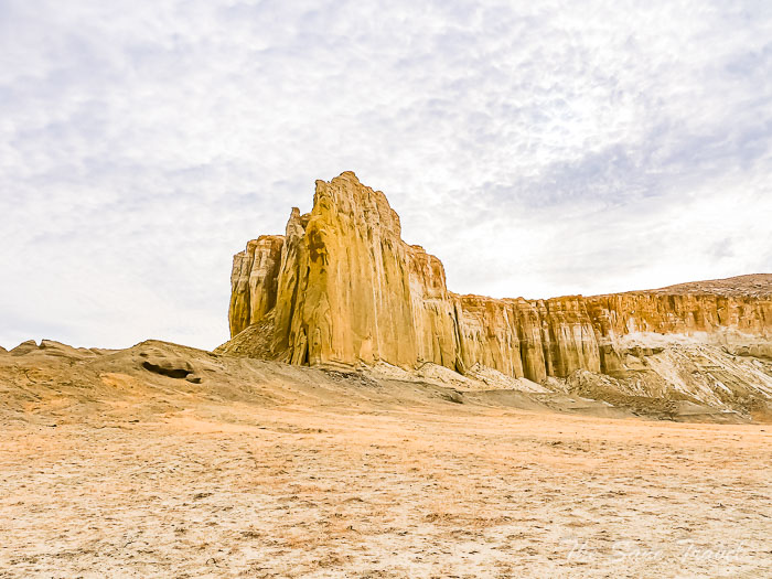
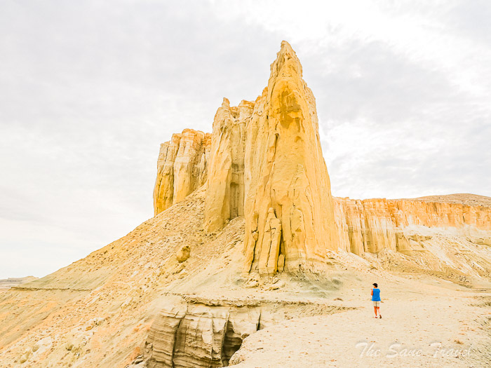
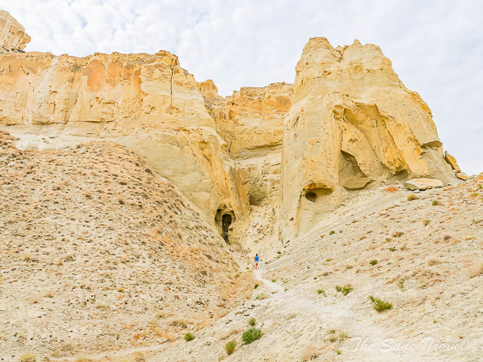
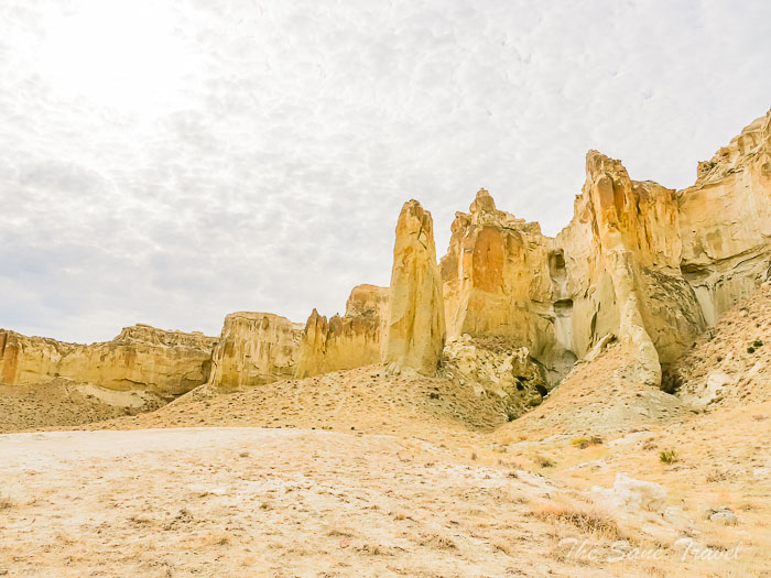
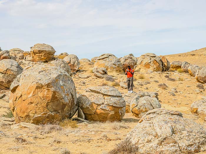
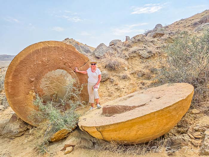
The place with an unknown name
I believe there are many other unnamed locations in this area, given the abundance of beautiful hills and cliffs. The light tan and yellow sandstone cliffs and limited vegetation are typical of the Mangystau desert landscape. The presence of a small person, our guide, in the picture highlights the size of the large rock formations, which attract adventurous travellers and photographers.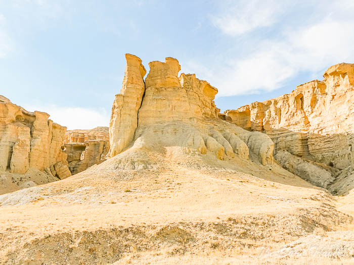
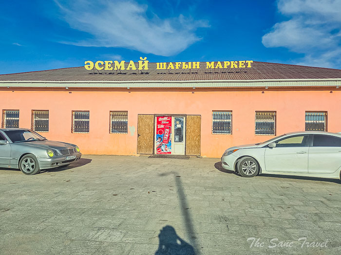
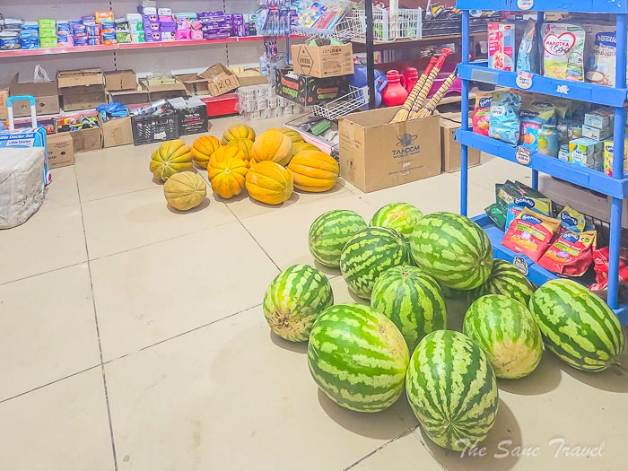
Before going to our lodging, we stopped briefly in Shetpe village to visit a local grocery store. 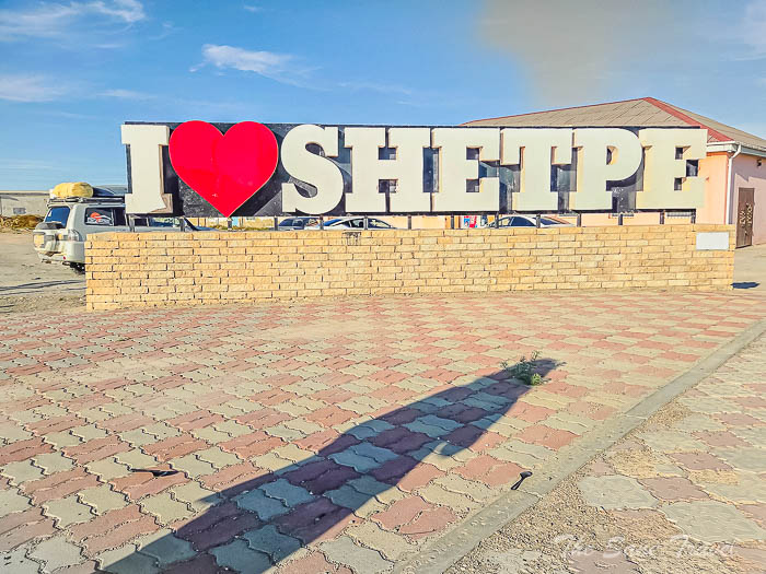
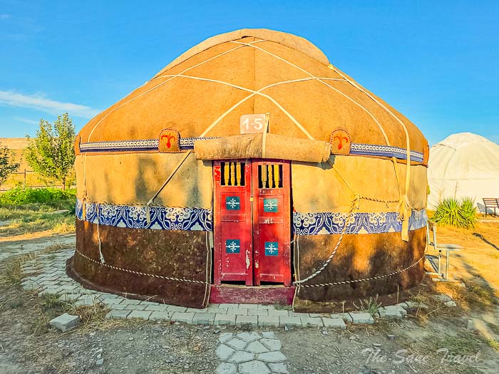
 We spent the night at the ethno village Kogez.
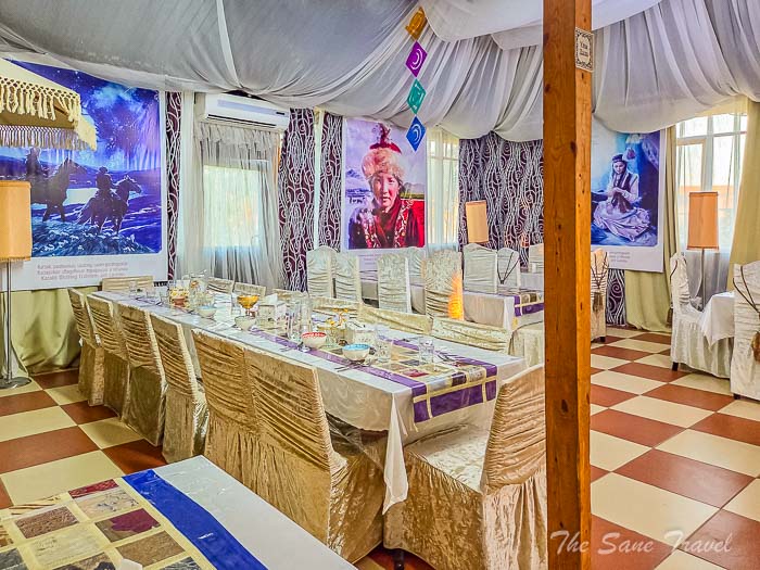
Ethno village Kogez
Ethno village is situated in the scenic mountainous region of Mangistau, close to well-known tourist attractions. The park within the ethno village features traditional yurts made of felt, furnished with national ornamented decor, and a comfortable cafe is available for guests. We enjoyed our meals and had the chance to freshen up with a shower..JPG)
Day 5
Airakty Valley of Castles, Akmyshtau mountain range, Mount Sherkala, Kok-Kala tract and Torysh, Valley of Balls. Distance covered 150 kilometres, both on dirt and paved roads.
Airakty Valley of Castles
The Airakty Mountains are a striking group of peaks with unique features, including sharp cliffs and intricate crevices. These natural formations, created by the forces of water, wind, and time, give the mountains the appearance of handcrafted fortresses. The nickname "Valley of Castles" was given to them by Ukrainian writer and poet Taras Shevchenko, who was living in exile in Mangystau in the mid-19th century and was the first to document these mountains in drawings.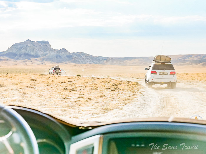
Akmyshtau mountain range
The Akmyshtau massif, located near Mount Sherkala and the Valley of Balls, is a small and dramatic range with cliffs that extend in various directions. The northern part of the massif is made up of eroded and swollen Cretaceous rocks. Measuring just over 1100 meters in length and around 950 meters in width, this natural formation is like a temple created by nature. These impressive stone remnants of the Akmyshtau massif are connected to the northern slopes of the Western Karatau mountain range.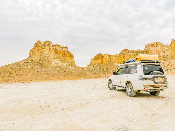
Mount Sherkala
The Sherkala ridge is a meandering ridge located to the east of the central part of the Zhem River near Shetpe village. It spans approximately 100 kilometres from south-west to north-east and has a width of up to 20 kilometres. In Kazakh, Sherkala translates to the Lion's Fortress, with Sher meaning Lion and Kala meaning Fortress. Historically, Mount Sherkala was once an island in the ocean near the coastal zone. The area surrounding the mountain is steeped in legends and stories. Legend has it that a fortress was constructed on Mount Sherkala to protect travellers along the Great Silk Road that passed through the region. It is said that Mount Sherkala has the power to grant wishes to those who make them while circling the mountain in a clockwise direction. 
Kok-Kala tract
The Kok-Kala tract, also known as Kokala, is a picturesque small gorge filled with vividly colourful rocks. Layers of variously colored limestone, clay, and ancient sediments have combined to create a visually stunning display. Scientists have linked the origins of these rock formations to the Jurassic period, providing a glimpse into a world millions of years in the past. The name "Kok-Kala" translates to "Blue Fortress" or "Blue Mountain," adding an element of mystery to the location. As you approach the Kokala Gorge, the light-colored rocks contrast sharply with the surrounding orange-brown hills. This breathtaking landscape was formed by tectonic activity, which lifted a massive layer of prehistoric rock above the surface. Over the course of many years, the natural wonder has been created due to erosion caused by water, wind, and the passage of time. Dark layers within the rocks contain remnants of plants from the Jurassic era, with scientists estimating their age to be about 170-200 million years old. Although Kok-Kala may not be a well-known tourist spot, it is worth visiting during a tour of the Mangystau region.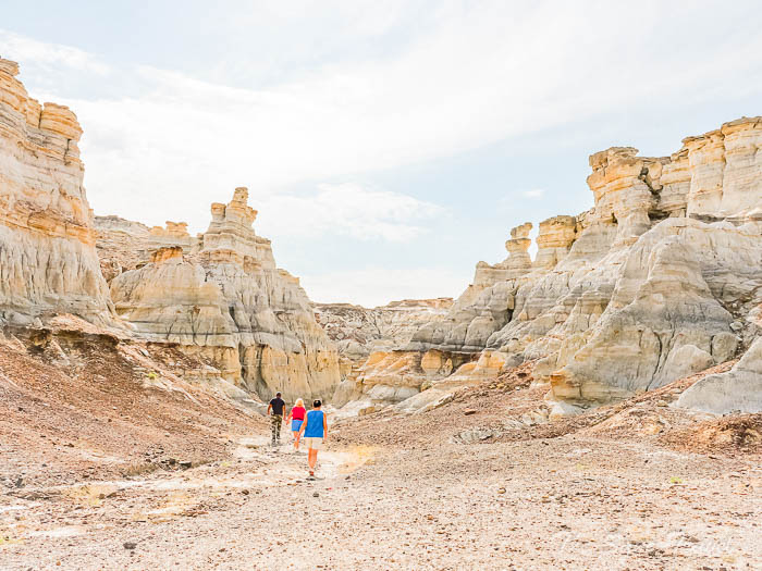
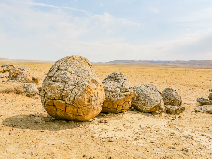
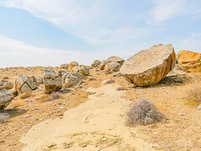
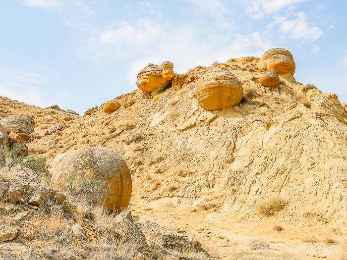
Torysh, Valley of the balls
Torysh is a striking site, known for its large collection of stone spheres measuring between 1 and 3 meters in diameter, which has led to it being called the "Valley of Balls." These formations may resemble objects created by giants for various games, but they are actually natural geological formations estimated to be between 40 and 60 million years old. While the Valley of Balls is impressive, similar formations can be found in other parts of the world, such as the Moeraki Boulders in New Zealand, Champ Island in Russia, and Bowling Ball Beach in California. However, Mangystau boasts the largest concentration of these large stones, covering several kilometres with thousands of them scattered throughout. Some scientists believe that these spherical boulders were formed in a tectonic fault zone following a significant earthquake, causing rock to rotate, melt, and solidify into a rounded shape. Known locally as "stone rams," these giant boulders are found throughout the valley, called "torysh", meaning "water depression" in translation.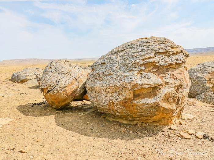
It was the end of our tour and we were brought back to our hotel in Aktau.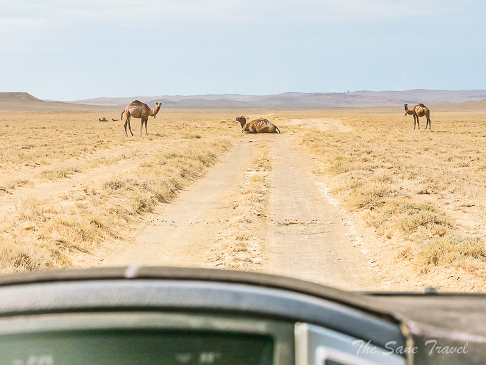
Practical tips
When to visit
The climate in the Mangystau region is typically continental, with notable temperature changes that can impact travel plans. This expansive steppe area is known for its arid conditions, with hot summers and milder winters. During the summer, temperatures can rise above 40 degrees Celsius during the day but drop to around 30 degrees at night. In winter, daytime temperatures range from 5 to 10 degrees Celsius, falling to about -5 degrees at night. Snowfall is common, especially in January, accompanied by cold winds. Daylight is limited, with dusk arriving around 6 pm. Winter travel and camping are recommended only for those with experience. The best times to visit Mangystau are in April, May, September, and October. Spring is particularly beautiful, with vibrant green grass and clear blue skies. Light rain may occur occasionally, usually 1-2 days a month. Daytime temperatures in spring range from 20 to 30 degrees Celsius, cooling down to 10-15 degrees at night. September and October offer comfortable temperatures as the heat of summer begins to fade. During my visit in early September, temperatures were slightly above 30 degrees Celsius during the day and around 20 degrees at night.
How to get to Mangystau
The most convenient option is to take a flight to Aktau airport and begin your tour from Aktau city, which is exactly what we did.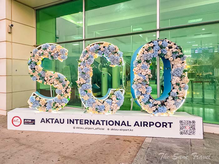
What to expect
Anticipate travelling on rough dirt roads for the majority of the journey. Restrooms were not accessible for most of the tour, but there was enough drinking water provided. Limited water was available for personal hygiene, with no shower facilities. Accommodations consisted of sleeping in tents with sleeping bags. Internet access was only available in urban areas.
Disclosure: I paid for everything myself.
Like it? Pin it! 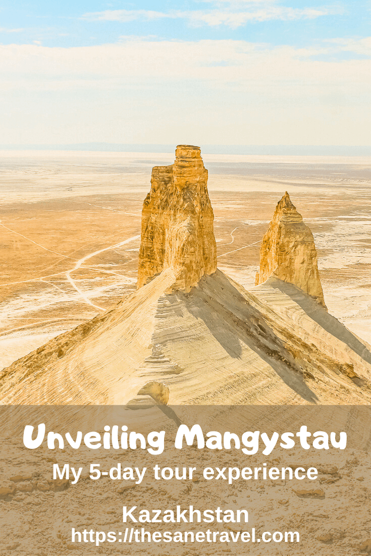
What did you think? Have you been to Kazakhstan? I would love to hear from you, so please add your comment below.
Author: Anita Sane

About the author
Anita is a part-time traveller, passionate photographer and a retired career woman from Latvia, travelling mostly solo for more than 15 years. She is a skilled travel planner who plans and executes her travels by herself. Anita wants to show you how to travel the world and open your mind to new experiences. Follow her on Facebook, Instagram, Pinterest, Twitter and Bloglovin.
Report
My comments